Mariposa & Tuolumne Counties, California

Documented gold claims in the California Mother Lode.

I locate, hold, and sell unpatented placer gold mining claims — and every claim goes out the door with its complete recorded archive: the location notice, the notarized deed, the county filings, the BLM receipts, and GPS corners checked against the official federal plat.

You are not buying a mystery.

1 Claim for sale now

Pennyweight Placer, on the South Fork Tuolumne in Tuolumne County. Claims are listed as they are located and cleared.

100% Traceable filings

Every filing traces to a recorded public document. You can verify each fact yourself, from the source, without taking my word for it.

0 Gold guarantees

Gold is never guaranteed. Anyone who promises you gold is selling you a story. What I sell is documented ground.

Currently for sale

Pennyweight Placer

A 20-acre unpatented placer claim on the South Fork Tuolumne River, about half a mile below the Yosemite National Park boundary.

Pennyweight Placer — South Fork Tuolumne River

$8,500or best offer
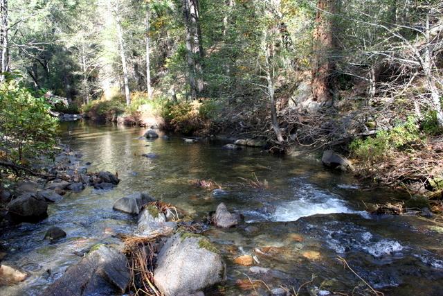
The South Fork Tuolumne River running through the Pennyweight Placer claim.
The South Fork Tuolumne, on the claim.
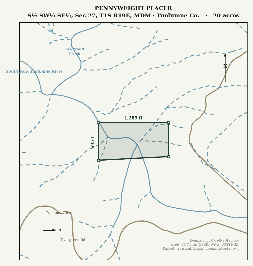
Survey boundary map of the Pennyweight Placer claim on the South Fork Tuolumne.
The claim boundary as surveyed — 1,289 by 695 feet. Open full size.

“As close to mining in Yosemite as you can legally get.”

Mining is prohibited inside national parks. The river leaves Yosemite and flows about three-quarters of a river mile before entering this claim, and per BLM records there is no other mining claim in that gap — making this the first claim on the river below the park. Checked August 2026.

  • 20 acres — S½ SW¼ SE¼, Section 27, T1S R19E, Mount Diablo Meridian, Tuolumne County.
  • Year-round water, exposed bedrock, and gravel bars — a canyon that stays green when the rest of the Mother Lode is brown.
  • Signed turnout right off Highway 120, the main Yosemite route, then a short Forest Service dirt road. Buck Meadows and Groveland are minutes west for gas, food, and supplies.
  • BLM maintenance paid through the 2027 assessment year — the new owner’s first deadline is September 1, 2027.
  • Financing available for a qualified buyer: $2,500 down, $500/month for 12 months, no interest. Signed agreement required.

The standard

The paperwork is the product.

Most claim sellers hand you a serial number and a hand sketch. I hand over the recorded archive, so every fact in the listing is one you can check independently.

01

The recorded notice

The original county-recorded notice of location, with the general course and dimensions the state requires.

02

A clean chain

A notarized deed, every annual county filing, and the BLM transfer on the federal record.

03

Fees current

BLM maintenance receipts showing the claim in good standing, with your first deadline stated in plain dates.

04

Verified corners

GPS boundary corners checked against the official BLM digital plat, delivered as a Google Earth file you can open on your phone.

05

History, cited

District history sourced from the state geologist and the federal minerals database. Sources named. Nothing invented.

06

Transfer done together

The notarized claim deed and the BLM filing handled with you, so you start in clean standing.

What an unpatented claim is — plainly

You get the exclusive right to the locatable minerals and the right to work them on federal land: prospecting, mining, and camping while you work. It is not deeded homesite land — no cabins, no living on it. Keeping it costs about $200 a year paid to BLM each September, or the small-miner fee waiver if you qualify. It is a possessory mineral interest, not fee-simple real estate.

Read the full standard →

“I make no claims about gold values — anyone who guarantees you gold is selling you a story.” Northern General

Gold country

The Big Oak Flat district, and the ditch that watered it.

The placer camps at Big Oak Flat, Garrote (today’s Groveland), and Deer Flat produced roughly $25 million in gold at 1850s prices — on the order of a million ounces. The ground was rich but dry, so in 1855 the miners built forty miles of ditch and timber flumes standing up to 265 feet to bring a river to it. That river was the South Fork Tuolumne.

“I’d rather answer twenty questions than have one surprised buyer.” Northern General